
Diablo Lake topographic map
Interactive map
Click on the map to display elevation.
About this map
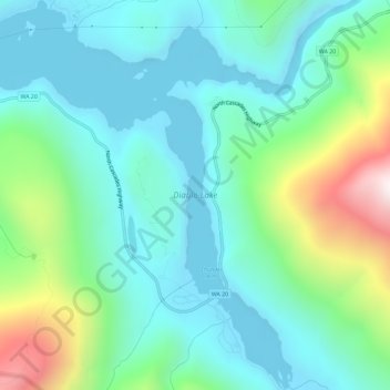
Name: Diablo Lake topographic map, elevation, terrain.
Location: Diablo Lake, Whatcom County, Washington, United States (48.68160 -121.13257 48.72013 -121.08459)
Average elevation: 643 m
Minimum elevation: 362 m
Maximum elevation: 1,538 m
Diablo Lake is a reservoir in the North Cascade mountains of northern Washington state, United States. Created by Diablo Dam, the lake is located between Ross Lake and Gorge Lake on the Skagit River at an elevation of 1,201 feet (366 m) above sea level. Diablo Lake is part of the Skagit River Hydroelectric Project and managed by Seattle City Light.
Other topographic maps
Click on a map to view its topography, its elevation and its terrain.
Lummi Island
United States > Washington > Whatcom County
Lummi Island, Whatcom County, Washington, United States
Average elevation: 24 m
Ross Lake
United States > Washington > Whatcom County
Ross Lake, Whatcom County, Washington, United States
Average elevation: 1,314 m
Bellingham
United States > Washington > Whatcom County
Bellingham, Whatcom County, Washington, United States
Average elevation: 89 m
Hampton
United States > Washington > Whatcom County
Hampton, Whatcom County, Washington, 98276, United States
Average elevation: 24 m
Custer
United States > Washington > Whatcom County
Custer, Whatcom County, Washington, 98240, United States
Average elevation: 20 m
Balford
United States > Washington > Whatcom County
Balford, Whatcom County, Washington, 98266, United States
Average elevation: 342 m
Acme
United States > Washington > Whatcom County
Acme, Whatcom County, Washington, 98220, United States
Average elevation: 420 m
Birch Bay
United States > Washington > Whatcom County
Birch Bay, Whatcom County, Washington, United States
Average elevation: 21 m
Point Roberts
United States > Washington > Whatcom County > Point Roberts
Point Roberts, Whatcom County, Washington, 98281, United States
Average elevation: 9 m
Ferndale
United States > Washington > Whatcom County > Ferndale
Ferndale, Whatcom County, Washington, 98248, United States
Average elevation: 29 m
Sudden Valley
United States > Washington > Whatcom County
Sudden Valley, Whatcom County, Washington, 98228, United States
Average elevation: 239 m
Ferndale
United States > Washington > Whatcom County
Ferndale, Whatcom County, Washington, United States
Average elevation: 29 m
Bellingham
United States > Washington > Whatcom County > Bellingham
Bellingham, Whatcom County, Washington, 98225-3243, United States
Average elevation: 129 m
Blaine
United States > Washington > Whatcom County > Blaine
Blaine, Whatcom County, Washington, United States
Average elevation: 23 m
Mount Baker
United States > Washington > Whatcom County
Mount Baker, Whatcom County, Washington, United States
Average elevation: 2,699 m