
Temotu topographic map
Interactive map
Click on the map to display elevation.
About this map
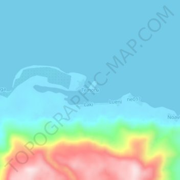
Name: Temotu topographic map, elevation, terrain.
Location: Temotu, Solomon Islands (-10.67644 166.04167 -10.63644 166.08167)
Average elevation: 79 m
Minimum elevation: 0 m
Maximum elevation: 421 m
Other topographic maps
Click on a map to view its topography, its elevation and its terrain.
Santa Cruz Islands
Santa Cruz Islands, Graciosa Bay Ward, Temotu, Solomon Islands
Average elevation: 1 m