
Lagos topographic map
Interactive map
Click on the map to display elevation.
About this map
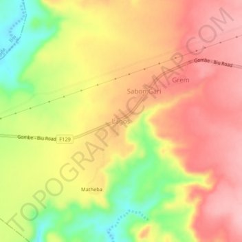
Name: Lagos topographic map, elevation, terrain.
Location: Lagos, Grim Damchoba, Hawul, Borno State, Nigeria (10.55410 11.98370 10.59410 12.02370)
Average elevation: 595 m
Minimum elevation: 504 m
Maximum elevation: 655 m
Other topographic maps
Click on a map to view its topography, its elevation and its terrain.
Bukar
Nigeria > Borno State > Hawul > Grim Damchoba > Bulama
Bukar, Bulama, Grim Damchoba, Hawul, Borno State, Nigeria
Average elevation: 542 m