
Everton topographic map
Interactive map
Click on the map to display elevation.
About this map
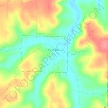
Name: Everton topographic map, elevation, terrain.
Location: Everton, Boone County, Arkansas, 72633, United States (36.14959 -92.91705 36.15884 -92.90260)
Average elevation: 292 m
Minimum elevation: 253 m
Maximum elevation: 339 m
Other topographic maps
Click on a map to view its topography, its elevation and its terrain.
Diamond City
United States > Arkansas > Boone County
Diamond City, Boone County, Arkansas, 72630, United States
Average elevation: 223 m
Harrison
United States > Arkansas > Boone County
Harrison, Boone County, Arkansas, 72601, United States
Average elevation: 371 m