
Cumberland Gap topographic map
Interactive map
Click on the map to display elevation.
About this map
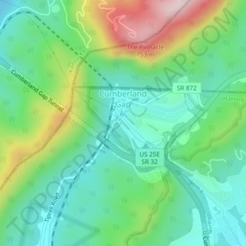
Name: Cumberland Gap topographic map, elevation, terrain.
Average elevation: 490 m
Minimum elevation: 363 m
Maximum elevation: 771 m
Other topographic maps
Click on a map to view its topography, its elevation and its terrain.
New Tazewell
United States > Tennessee > Claiborne County
When the railroad line was built from Knoxville through Cumberland Gap in the late 1880s, it bypassed the city of Tazewell. It is uncertain whether the railroad was unable to obtain right of way, or whether the decision was made because of topography, but the railroad depot was built about two miles to the…
Average elevation: 465 m