
Muhayil topographic map
Interactive map
Click on the map to display elevation.
About this map
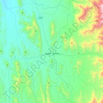
Name: Muhayil topographic map, elevation, terrain.
Location: Muhayil, 'Asir Province, 63713, Saudi Arabia (18.38639 41.88889 18.70639 42.20889)
Average elevation: 666 m
Minimum elevation: 235 m
Maximum elevation: 2,528 m
Other topographic maps
Click on a map to view its topography, its elevation and its terrain.