
Østerås topographic map
Interactive map
Click on the map to display elevation.
About this map
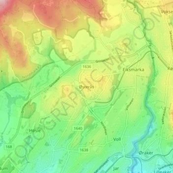
Name: Østerås topographic map, elevation, terrain.
Location: Østerås, Bærum, Akershus, 1361, Norway (59.92296 10.58438 59.96296 10.62438)
Average elevation: 132 m
Minimum elevation: 39 m
Maximum elevation: 269 m
Other topographic maps
Click on a map to view its topography, its elevation and its terrain.