
Stoughton topographic map
Interactive map
Click on the map to display elevation.
About this map
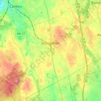
Name: Stoughton topographic map, elevation, terrain.
Location: Stoughton, Norfolk County, Massachusetts, United States (42.07276 -71.15018 42.16406 -71.05651)
Average elevation: 66 m
Minimum elevation: 11 m
Maximum elevation: 129 m
Other topographic maps
Click on a map to view its topography, its elevation and its terrain.
Lake Massapoag
United States > Massachusetts > Norfolk County > Sharon
Because of the lake and the fact that Sharon is at a slightly higher elevation than the surrounding towns, and because it is located on the main rail line going south from Boston, the shores of the lake developed into a minor summer resort with several large hotels, summer camps and cottage colonies. Temple…
Average elevation: 84 m
Wellesley Farms
United States > Massachusetts > Norfolk County > Wellesley > Wellesley Farms
Average elevation: 48 m