Geolocate

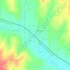
Calida topographic map

Click on the map to display elevation.

About this map

Name: Calida topographic map, elevation, terrain.

Location: Calida, Pawnee County, Oklahoma, United States (36.17313 -96.31807 36.21313 -96.27807)

Average elevation: 239 m

Minimum elevation: 216 m

Maximum elevation: 292 m

Other topographic maps

Click on a map to view its topography, its elevation and its terrain.
Terlton

United States > Oklahoma > Pawnee County

Average elevation: 250 m

Gear up for your next adventure:

📢Survival Whistles - Essential safety gear for signaling for help in mountain fog
📻Hand-Crank Emergency Radios - Stay updated on weather warnings in remote areas
👟Women's Trail Running Shoes - Agile footwear for fell running and technical trails
🧴Tick Removal Tools - Small, essential health tool for UK woodland and moorland
🌂Windproof Trekking Umbrellas - Surprising but effective rain protection on low-wind trails

As an Amazon Associate, this site earns from qualifying purchases at no extra cost to you.