Geolocate

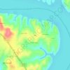
Terlton topographic map

Click on the map to display elevation.

About this map

Name: Terlton topographic map, elevation, terrain.

Location: Terlton, Pawnee County, Oklahoma, United States (36.17988 -96.49521 36.19282 -96.48549)

Average elevation: 250 m

Minimum elevation: 226 m

Maximum elevation: 291 m

Other topographic maps

Click on a map to view its topography, its elevation and its terrain.
Wes

United States > Oklahoma > Pawnee County

Average elevation: 240 m

Calida

United States > Oklahoma > Pawnee County

Average elevation: 239 m

Gear up for your next adventure:

🧣Neck Gaiters - Versatile protection against wind and cold
👟Waterproof Leg Gaiters - Keep mud and water out of your boots in boggy terrain
📸Action Camera Chest Mounts - Record your ascent following topographic paths hands-free
🔋Rechargeable Batteries - Eco-friendly power for headlamps and older GPS units
🦯Walking Poles - Supportive poles for long-distance walking

As an Amazon Associate, this site earns from qualifying purchases at no extra cost to you.