
Linwood topographic map
Interactive map
Click on the map to display elevation.
About this map
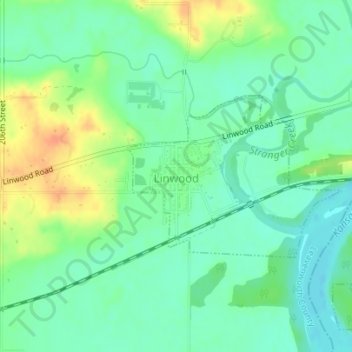
Name: Linwood topographic map, elevation, terrain.
Location: Linwood, Leavenworth County, Kansas, United States (38.99529 -95.04396 39.00772 -95.02280)
Average elevation: 248 m
Minimum elevation: 233 m
Maximum elevation: 275 m
Other topographic maps
Click on a map to view its topography, its elevation and its terrain.
Leavenworth
United States > Kansas > Leavenworth County > Leavenworth
Leavenworth, Leavenworth County, Kansas, 66048, United States
Average elevation: 277 m