
Monatélé topographic map
Interactive map
Click on the map to display elevation.
About this map
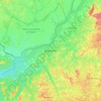
Name: Monatélé topographic map, elevation, terrain.
Location: Monatélé, Lekié, Centre, Cameroon (4.15881 11.07639 4.35968 11.43604)
Average elevation: 442 m
Minimum elevation: 310 m
Maximum elevation: 786 m
Other topographic maps
Click on a map to view its topography, its elevation and its terrain.