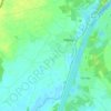
Owschlag topographic map
Click on the map to display elevation.
About this map

Name: Owschlag topographic map, elevation, terrain.
Average elevation: 15 m
Minimum elevation: 1 m
Maximum elevation: 98 m
Other topographic maps
Click on a map to view its topography, its elevation and its terrain.


Lütjenbornholt
Deutschland > Schleswig-Holstein > Kreis Rendsburg-Eckernförde > Bornholt
Average elevation: 18 m
Ramsdorf
Deutschland > Schleswig-Holstein > Kreis Rendsburg-Eckernförde > Owschlag
Average elevation: 16 m

Aukrug
Deutschland > Schleswig-Holstein > Kreis Rendsburg-Eckernförde
Die Gemeinde ist ein staatlich anerkannter Erholungsort und liegt im Herzen des 380 km² großen Naturparks Aukrug mit Wiesen und Feldern, Heide, Mooren, Teichen und kleinen Flussläufen. Durch den Abbau von Torf und der anschließenden Herstellung von Torfkohle, die ähnlich wie Holzkohle hergestellt wird,…
Average elevation: 23 m

Dänisch-Nienhof
Deutschland > Schleswig-Holstein > Kreis Rendsburg-Eckernförde
Average elevation: 17 m


Trömbek
Deutschland > Schleswig-Holstein > Kreis Rendsburg-Eckernförde > Lehmkuhl
Average elevation: 20 m
Neu-Bülk
Deutschland > Schleswig-Holstein > Kreis Rendsburg-Eckernförde > Rabendorf
Average elevation: 26 m
Knoop
Deutschland > Schleswig-Holstein > Kreis Rendsburg-Eckernförde > Altenholz
Average elevation: 18 m
Guckelsby
Deutschland > Schleswig-Holstein > Kreis Rendsburg-Eckernförde > Sieseby
Average elevation: 13 m
Norby
Deutschland > Schleswig-Holstein > Kreis Rendsburg-Eckernförde > Rieseby
Average elevation: 21 m
Osselberg
Deutschland > Schleswig-Holstein > Kreis Rendsburg-Eckernförde > Blumenthal
Average elevation: 39 m
Aschberg
Deutschland > Schleswig-Holstein > Kreis Rendsburg-Eckernförde > Ascheffel
Average elevation: 39 m

Glüsing
Deutschland > Schleswig-Holstein > Kreis Rendsburg-Eckernförde > Hohenwestedt
Average elevation: 38 m


Vaasbüttel
Deutschland > Schleswig-Holstein > Kreis Rendsburg-Eckernförde > Hohenwestedt
Average elevation: 44 m


Westerfeld
Deutschland > Schleswig-Holstein > Kreis Rendsburg-Eckernförde > Höxmark
Average elevation: 12 m

Fellhorst
Deutschland > Schleswig-Holstein > Kreis Rendsburg-Eckernförde > Hummelfeld
Average elevation: 29 m

Aschenberg
Deutschland > Schleswig-Holstein > Kreis Rendsburg-Eckernförde > Großwaabs
Average elevation: 22 m


Nordberg
Deutschland > Schleswig-Holstein > Kreis Rendsburg-Eckernförde > Krieseby
Average elevation: 24 m

Borghorstermühle
Deutschland > Schleswig-Holstein > Kreis Rendsburg-Eckernförde > Austerlitz
Average elevation: 20 m

Koppelreihe
Deutschland > Schleswig-Holstein > Kreis Rendsburg-Eckernförde > Haale
Average elevation: 15 m

Nienkattbek
Deutschland > Schleswig-Holstein > Kreis Rendsburg-Eckernförde > Jevenstedt
Average elevation: 15 m
Schoolstraat
Deutschland > Schleswig-Holstein > Kreis Rendsburg-Eckernförde > Luhnstedt
Average elevation: 24 m

Fischerhütte
Deutschland > Schleswig-Holstein > Kreis Rendsburg-Eckernförde > Steenfeld
Average elevation: 14 m

Hegenholt
Deutschland > Schleswig-Holstein > Kreis Rendsburg-Eckernförde > Neu Duvenstedt
Average elevation: 24 m

Sande
Deutschland > Schleswig-Holstein > Kreis Rendsburg-Eckernförde > Holzbunge
Average elevation: 19 m

Neuholtsee
Deutschland > Schleswig-Holstein > Kreis Rendsburg-Eckernförde > Holtsee
Average elevation: 18 m


Hohenkamp
Deutschland > Schleswig-Holstein > Kreis Rendsburg-Eckernförde > Elsdorf-Westermühlen
Average elevation: 11 m

Süderholm
Deutschland > Schleswig-Holstein > Kreis Rendsburg-Eckernförde > Christiansholm
Average elevation: 1 m


Lohklint
Deutschland > Schleswig-Holstein > Kreis Rendsburg-Eckernförde > Breiholz
Average elevation: 4 m

Ruckforde
Deutschland > Schleswig-Holstein > Kreis Rendsburg-Eckernförde > Revensdorf
Average elevation: 16 m

Hasselrade
Deutschland > Schleswig-Holstein > Kreis Rendsburg-Eckernförde > Felde
Average elevation: 17 m

Frauendamm
Deutschland > Schleswig-Holstein > Kreis Rendsburg-Eckernförde > Klein-Königsförde
Average elevation: 18 m

Fiedelhof
Deutschland > Schleswig-Holstein > Kreis Rendsburg-Eckernförde > Böhnhusen
Average elevation: 44 m

Birkensee
Deutschland > Schleswig-Holstein > Kreis Rendsburg-Eckernförde > Gammelby
Average elevation: 14 m

Krähenberg
Deutschland > Schleswig-Holstein > Kreis Rendsburg-Eckernförde > Karby
Average elevation: 11 m

Basdorf
Deutschland > Schleswig-Holstein > Kreis Rendsburg-Eckernförde > Sönderby
Average elevation: 26 m


Grönwohld
Deutschland > Schleswig-Holstein > Kreis Rendsburg-Eckernförde > Krusendorf
Average elevation: 19 m

Falkenburg
Deutschland > Schleswig-Holstein > Kreis Rendsburg-Eckernförde > Hohenwestedt
Average elevation: 44 m

Kronsberg
Deutschland > Schleswig-Holstein > Kreis Rendsburg-Eckernförde > Waabs
Average elevation: 27 m