
San Juan de Jarpa topographic map
Interactive map
Click on the map to display elevation.
About this map
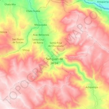
Name: San Juan de Jarpa topographic map, elevation, terrain.
Location: San Juan de Jarpa, Province of Chupaca, Junín, Peru (-12.19441 -75.53246 -12.04031 -75.37645)
Average elevation: 4,110 m
Minimum elevation: 3,313 m
Maximum elevation: 4,614 m
Other topographic maps
Click on a map to view its topography, its elevation and its terrain.