
Tennant Creek topographic map
Interactive map
Click on the map to display elevation.
About this map
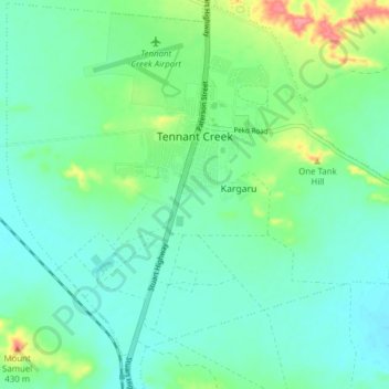
Name: Tennant Creek topographic map, elevation, terrain.
Average elevation: 366 m
Minimum elevation: 345 m
Maximum elevation: 430 m
Other topographic maps
Click on a map to view its topography, its elevation and its terrain.
Alpurrurulam
Alpurrurulam, Barkly Region, Northern Territory, Australia
Average elevation: 201 m
Barrow Creek
Australia > Barkly Region > Barrow Creek
Barrow Creek, Davenport, Barkly Region, Northern Territory, Australia
Average elevation: 445 m