
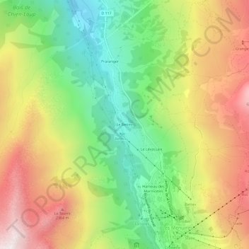
Le Bettex topographic map
Interactive map
Click on the map to display elevation.
About this map
Name: Le Bettex topographic map, elevation, terrain.
Average elevation: 1,945 m
Minimum elevation: 1,453 m
Maximum elevation: 2,527 m
Other topographic maps
Click on a map to view its topography, its elevation and its terrain.
Saint-Martin-de-Belleville
France > Auvergne-Rhône-Alpes > Savoy > Les Belleville
Saint-Martin-de-Belleville, Les Belleville, Albertville, Savoy, Auvergne-Rhône-Alpes, Metropolitan France, 73440, France
Average elevation: 1,989 m
Villarly
France > Auvergne-Rhône-Alpes > Savoy > Les Belleville
Villarly, Saint-Jean-de-Belleville, Les Belleville, Albertville, Savoy, Auvergne-Rhône-Alpes, Metropolitan France, 73440, France
Average elevation: 1,322 m