Geolocate

Mankato topographic map

Interactive map

Click on the map to display elevation.

About this map

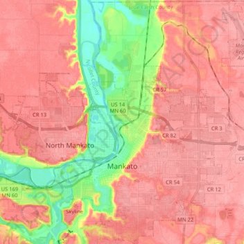
Name: Mankato topographic map, elevation, terrain.

Location: Mankato, Blue Earth County, Minnesota, 56001, United States (44.12684 -94.04599 44.24164 -93.90565)

Average elevation: 285 m

Minimum elevation: 226 m

Maximum elevation: 314 m

Other topographic maps

Click on a map to view its topography, its elevation and its terrain.

Madison Lake

United States > Minnesota > Blue Earth County

Madison Lake, Blue Earth County, Minnesota, 56063, United States

Average elevation: 315 m

Hodapp Marsh

United States > Minnesota > Blue Earth County

Hodapp Marsh, Blue Earth County, Minnesota, United States

Average elevation: 306 m

Pemberton

United States > Minnesota > Blue Earth County > Pemberton

Pemberton, Blue Earth County, Minnesota, United States

Average elevation: 316 m