
Sibley topographic map
Interactive map
Click on the map to display elevation.
About this map
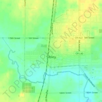
Name: Sibley topographic map, elevation, terrain.
Location: Sibley, Osceola County, Iowa, United States (43.38962 -95.76170 43.41136 -95.72796)
Average elevation: 462 m
Minimum elevation: 450 m
Maximum elevation: 473 m
Other topographic maps
Click on a map to view its topography, its elevation and its terrain.
Hawkeye Point
United States > Iowa > Osceola County
Hawkeye Point, Osceola County, Iowa, United States
Average elevation: 498 m
Ashton
United States > Iowa > Osceola County
Ashton, Osceola County, Iowa, United States
Average elevation: 448 m