
Hawkeye Point topographic map
Interactive map
Click on the map to display elevation.
About this map
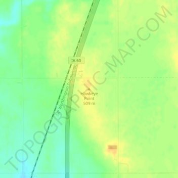
Name: Hawkeye Point topographic map, elevation, terrain.
Location: Hawkeye Point, Osceola County, Iowa, United States (43.45992 -95.70895 43.46002 -95.70885)
Average elevation: 498 m
Minimum elevation: 483 m
Maximum elevation: 510 m
Other topographic maps
Click on a map to view its topography, its elevation and its terrain.
Sibley
United States > Iowa > Osceola County
Sibley, Osceola County, Iowa, United States
Average elevation: 462 m
Ashton
United States > Iowa > Osceola County
Ashton, Osceola County, Iowa, United States
Average elevation: 448 m