
Kamara topographic map
Click on the map to display elevation.
About this map
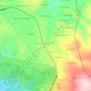
Name: Kamara topographic map, elevation, terrain.
Location: Kamara, Kamara ward, Kuresoi North, Nakuru, Kenya (-0.11742 35.65666 -0.07742 35.69666)
Average elevation: 2,542 m
Minimum elevation: 2,412 m
Maximum elevation: 2,717 m