
Bad Muskau - Mužakow topographic map
Interactive map
Click on the map to display elevation.
About this map
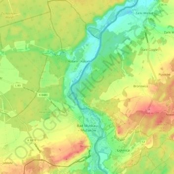
Name: Bad Muskau - Mužakow topographic map, elevation, terrain.
Location: Bad Muskau - Mužakow, Bad Muskau, Görlitz, Saxony, Germany (51.52883 14.67715 51.59724 14.73129)
Average elevation: 130 m
Minimum elevation: 93 m
Maximum elevation: 172 m
Other topographic maps
Click on a map to view its topography, its elevation and its terrain.
Neusalza-Spremberg
Germany > Saxony > Görlitz > Neusalza-Spremberg > Sonneberg
Average elevation: 355 m