Geolocate

Kami topographic map

Click on the map to display elevation.

About this map

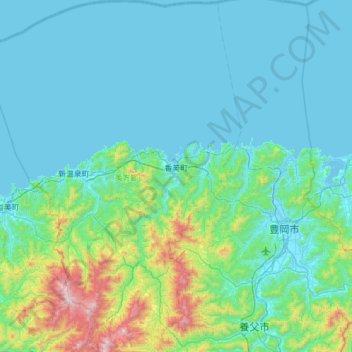
Name: Kami topographic map, elevation, terrain.

Location: Kami, Mikata County, Hyogo Prefecture, Japan (35.36586 134.41748 35.87016 134.74380)

Average elevation: 172 m

Minimum elevation: -3 m

Maximum elevation: 1,296 m

Gear up for your next adventure:

🪓Outdoor Multitools - Versatile tools for hiking and camping
🔭Compact Hiking Binoculars - Lightweight optics for scouting terrain and spotting wildlife
📢Survival Whistles - Essential safety gear for signaling for help in mountain fog
📷Camera Straps - Secure straps for carrying cameras while walking
🧥Packable Down Jackets - Lightweight warmth that compresses small in your bag

As an Amazon Associate, this site earns from qualifying purchases at no extra cost to you.