
Sururi Mahallesi topographic map
Interactive map
Click on the map to display elevation.
About this map
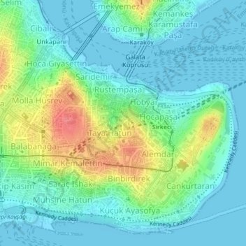
Name: Sururi Mahallesi topographic map, elevation, terrain.
Location: Sururi Mahallesi, Fatih, Istanbul, Marmara Region, Turkey (41.01157 28.97003 41.01468 28.97365)
Average elevation: 19 m
Minimum elevation: -1 m
Maximum elevation: 71 m