Geolocate

Flå topographic map

Click on the map to display elevation.

About this map

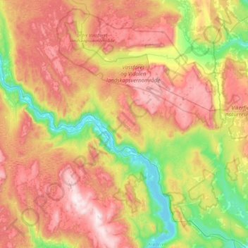
Name: Flå topographic map, elevation, terrain.

Location: Flå, Buskerud, 3539, Norway (60.29666 9.09583 60.57193 9.84672)

Average elevation: 719 m

Minimum elevation: 128 m

Maximum elevation: 1,458 m

Other topographic maps

Click on a map to view its topography, its elevation and its terrain.

Geilo

Norway > Buskerud

Average elevation: 871 m

Tunhovd

Norway > Buskerud

Average elevation: 846 m

Veggli

Norway > Buskerud

Average elevation: 354 m

Hemsedal

Norway > Buskerud

Average elevation: 827 m

Geilo

Norway > Buskerud

Average elevation: 871 m

Geilo

Norway > Buskerud

Average elevation: 871 m

Helgerud

Norway > Buskerud > Lierbyen

Average elevation: 109 m

Helgerud

Norway > Buskerud > Lierbyen

Average elevation: 109 m

Geilo

Norway > Buskerud

Average elevation: 871 m

Myro

Norway > Buskerud > Hol

Average elevation: 805 m

Liagardane

Norway > Buskerud

Average elevation: 609 m

Blestølen

Norway > Buskerud

Average elevation: 657 m

Svelvik

Norway > Buskerud

Average elevation: 138 m

Efesus

Norway > Buskerud

Average elevation: 884 m

Skrim

Norway > Buskerud

Average elevation: 621 m

Vikersund

Norway > Buskerud

Average elevation: 217 m

Norefjell

Norway > Buskerud

Average elevation: 758 m

Granåsen

Norway > Buskerud

Average elevation: 609 m

Eggedal

Norway > Buskerud

Average elevation: 482 m

Uvdal alpinsenter

Norway > Buskerud

Average elevation: 893 m

Hesteberget

Norway > Buskerud

Average elevation: 1,345 m

Torpo

Norway > Buskerud

Average elevation: 543 m

Hønefoss

Norway > Buskerud

Average elevation: 132 m

Hønefoss

Norway > Buskerud

Average elevation: 132 m

Gear up for your next adventure:

🧣Neck Gaiters - Versatile protection against wind and cold
🧤Thermal Touchscreen Gloves - Stay warm while operating your GPS or smartphone camera
🧥Waterproof Hiking Jackets - Rain protection for walking in all weather conditions
🌂Windproof Trekking Umbrellas - Surprising but effective rain protection on low-wind trails
🧘Folding Sit Mats - Dry and warm seat for map-reading breaks on damp ground

As an Amazon Associate, this site earns from qualifying purchases at no extra cost to you.