
Hanger River topographic map
Interactive map
Click on the map to display elevation.
About this map
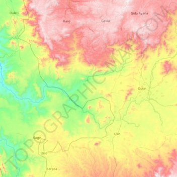
Name: Hanger River topographic map, elevation, terrain.
Location: Hanger River, Kemashi, Benishangul-Gumuz Region, Ethiopia (9.39699 36.03809 9.72976 36.78420)
Average elevation: 1,472 m
Minimum elevation: 838 m
Maximum elevation: 2,327 m
Other topographic maps
Click on a map to view its topography, its elevation and its terrain.
Kurmuk
Ethiopia > Benishangul-Gumuz Region
Kurmuk, Asosa, Benishangul-Gumuz Region, Ethiopia
Average elevation: 698 m