
Hopeton topographic map
Interactive map
Click on the map to display elevation.
About this map
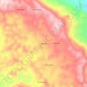
Name: Hopeton topographic map, elevation, terrain.
Location: Hopeton, Saint James, Cornwall County, Jamaica (18.37344 -77.88674 18.41344 -77.84674)
Average elevation: 419 m
Minimum elevation: 136 m
Maximum elevation: 561 m
Other topographic maps
Click on a map to view its topography, its elevation and its terrain.