
Gargellen topographic map
Interactive map
Click on the map to display elevation.
About this map
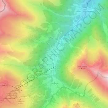
Name: Gargellen topographic map, elevation, terrain.
Average elevation: 1,799 m
Minimum elevation: 1,241 m
Maximum elevation: 2,511 m
Other topographic maps
Click on a map to view its topography, its elevation and its terrain.
Montafon
Österreich > Vorarlberg > Bezirk Bludenz > Gemeinde Sankt Gallenkirch
Montafon, Gemeinde Sankt Gallenkirch, Bezirk Bludenz, Vorarlberg, 6791, Österreich
Average elevation: 1,566 m
Gortipohl
Österreich > Vorarlberg > Bezirk Bludenz > Gemeinde Sankt Gallenkirch > Gortipohl
Gortipohl, Gemeinde Sankt Gallenkirch, Bezirk Bludenz, Vorarlberg, 6791, Österreich
Average elevation: 1,324 m