Geolocate

Redbrook topographic map

Click on the map to display elevation.

About this map

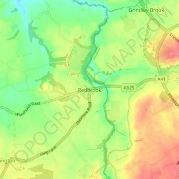
Name: Redbrook topographic map, elevation, terrain.

Location: Redbrook, Wrexham, Wales, SY13 3AD, United Kingdom (52.94546 -2.75341 52.98546 -2.71341)

Average elevation: 89 m

Minimum elevation: 58 m

Maximum elevation: 124 m

Wrexham trails, hiking, mountain biking, running and outdoor activities

Other topographic maps

Click on a map to view its topography, its elevation and its terrain.

Penycae

United Kingdom > Wales > Wrexham

Average elevation: 350 m

Rhosddu

United Kingdom > Wales > Wrexham

Average elevation: 88 m

Gwersyllt

United Kingdom > Wales > Wrexham

Average elevation: 112 m

Bangor-on-Dee

United Kingdom > Wales > Wrexham

Average elevation: 30 m

Cefn

United Kingdom > Wales > Wrexham > Acrefair

Average elevation: 142 m

Gear up for your next adventure:

🎒Backpack Rain Covers - Universal waterproof covers to protect your gear from downpours
🛰️Outdoor GPS Navigation - Navigation devices for remote and off-grid areas
📸Action Camera Chest Mounts - Record your ascent following topographic paths hands-free
🗺️Ordnance Survey Maps - Essential paper maps for hiking across the UK national parks
📦Dry Bags - Waterproof bags to protect gear from rain

As an Amazon Associate, this site earns from qualifying purchases at no extra cost to you.