
Borgata Sangonetto topographic map
Interactive map
Click on the map to display elevation.
About this map
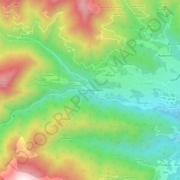
Name: Borgata Sangonetto topographic map, elevation, terrain.
Location: Borgata Sangonetto, Couasse, Turin, Piémont, Italie (45.03065 7.26000 45.07065 7.30000)
Average elevation: 914 m
Minimum elevation: 605 m
Maximum elevation: 1,382 m
Other topographic maps
Click on a map to view its topography, its elevation and its terrain.