
Dhulachaur topographic map
Interactive map
Click on the map to display elevation.
About this map
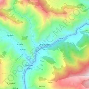
Name: Dhulachaur topographic map, elevation, terrain.
Location: Dhulachaur, Himali, Bajura, Nepal (29.45111 81.68692 29.53111 81.76692)
Average elevation: 1,774 m
Minimum elevation: 1,073 m
Maximum elevation: 3,139 m
Other topographic maps
Click on a map to view its topography, its elevation and its terrain.