
Campestre las Huertas topographic map
Interactive map
Click on the map to display elevation.
About this map
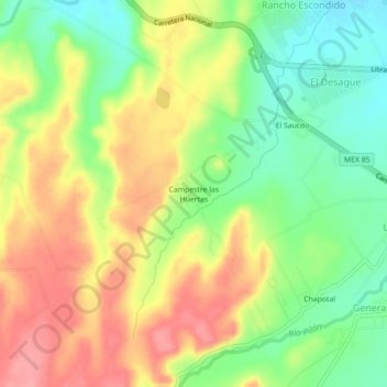
Name: Campestre las Huertas topographic map, elevation, terrain.
Average elevation: 473 m
Minimum elevation: 428 m
Maximum elevation: 520 m
Other topographic maps
Click on a map to view its topography, its elevation and its terrain.
Montemorelos
México > Nuevo León > Montemorelos
Montemorelos, Nuevo León, 67530, México
Average elevation: 418 m