
Stung Treng topographic map
Interactive map
Click on the map to display elevation.
About this map
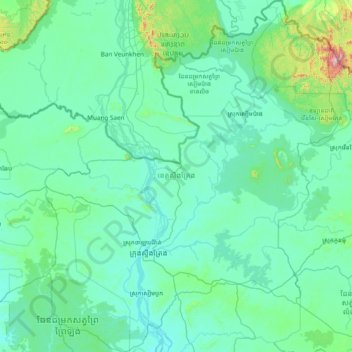
Name: Stung Treng topographic map, elevation, terrain.
Location: Stung Treng, Cambodia (13.11370 105.51947 14.59197 106.78918)
Average elevation: 127 m
Minimum elevation: 28 m
Maximum elevation: 1,445 m
Other topographic maps
Click on a map to view its topography, its elevation and its terrain.