Geolocate

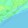
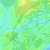
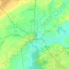
Legends topographic map

Click on the map to display elevation.

About this map

Name: Legends topographic map, elevation, terrain.

Location: Legends, Horry County, South Carolina, 29578, United States (33.73364 -79.02300 33.77364 -78.98300)

Average elevation: 12 m

Minimum elevation: 2 m

Maximum elevation: 16 m

Other topographic maps

Click on a map to view its topography, its elevation and its terrain.
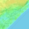
Myrtle Beach

United States > South Carolina > Horry County

Myrtle Beach features a predominantly flat topography characterized by its coastal plain setting. The area is situated just a few feet above sea level, with an average elevation of approximately 20 feet (6 meters), making it ideal for expansive sandy beaches and shallow tidal estuaries. The region is part of a…

Average elevation: 6 m
Conway

United States > South Carolina > Horry County

Average elevation: 10 m

Loris

United States > South Carolina > Horry County

Average elevation: 31 m

Aynor

United States > South Carolina > Horry County

Average elevation: 27 m

Aynor

United States > South Carolina > Horry County

Average elevation: 27 m

Conway

United States > South Carolina > Horry County

Average elevation: 10 m

Conway

United States > South Carolina > Horry County

Average elevation: 10 m

Gear up for your next adventure:

🔦Waterproof LED Headlamps - Hands-free lighting for evening treks and emergency navigation
🧭Professional Hiking Compasses - High-precision liquid-filled compasses for map reading and orientation
🍱Food Containers - Reusable containers for outdoor meals
🎒Backpack Rain Covers - Universal waterproof covers to protect your gear from downpours
🧥Waterproof Hiking Jackets - Rain protection for walking in all weather conditions

As an Amazon Associate, this site earns from qualifying purchases at no extra cost to you.