
Heyburn topographic map
Interactive map
Click on the map to display elevation.
About this map
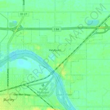
Name: Heyburn topographic map, elevation, terrain.
Location: Heyburn, Minidoka County, Idaho, 83336, United States (42.53624 -113.79337 42.57601 -113.72474)
Average elevation: 1,265 m
Minimum elevation: 1,258 m
Maximum elevation: 1,276 m
Other topographic maps
Click on a map to view its topography, its elevation and its terrain.
Rupert
United States > Idaho > Minidoka County
Rupert is located in southern Minidoka County at an elevation of 4,157 feet (1,267 m) above sea level. It is part of the agricultural region of the Snake River Plain known as Magic Valley, and is 3 miles (5 km) northwest of the Snake River. Interstate 84 passes 5 miles (8 km) to the south, and before its…
Average elevation: 1,268 m