Geolocate

Rocco topographic map

Click on the map to display elevation.

About this map

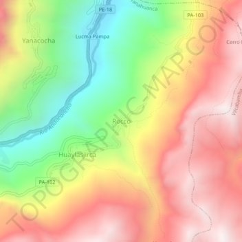
Name: Rocco topographic map, elevation, terrain.

Location: Rocco, Yanahuanca, Province of Daniel Carrión, Pasco, Peru (-10.50463 -76.50744 -10.46463 -76.46744)

Average elevation: 3,648 m

Minimum elevation: 2,996 m

Maximum elevation: 4,221 m

Other topographic maps

Click on a map to view its topography, its elevation and its terrain.

Ninacaca

Peru > Pasco

Average elevation: 4,253 m

Gear up for your next adventure:

Camping Shelters - Emergency and lightweight shelters for outdoor use
🍱Food Containers - Reusable containers for outdoor meals
🧰First Aid Kits - Essential safety kits for outdoor activities
❄️Walking Crampons - Added traction for icy slopes and winter peak bagging
🧤Hiking Gloves - Warm and durable gloves for cold-weather walks

As an Amazon Associate, this site earns from qualifying purchases at no extra cost to you.