
Bound Brook topographic map
Click on the map to display elevation.
About this map
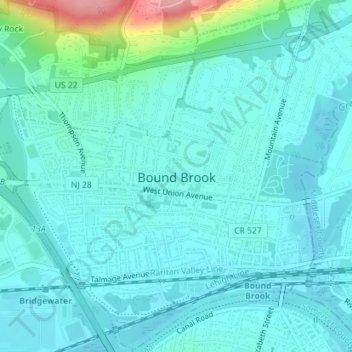
Name: Bound Brook topographic map, elevation, terrain.
Average elevation: 24 m
Minimum elevation: 4 m
Maximum elevation: 125 m
Other topographic maps
Click on a map to view its topography, its elevation and its terrain.
Basking Ridge
United States > New Jersey > Somerset County > Bernards Township
Average elevation: 98 m
Woods Tavern
United States > New Jersey > Somerset County > Hillsborough Township
Average elevation: 28 m
Bloomingdale
United States > New Jersey > Somerset County > Hillsborough Township
Average elevation: 29 m
Basking Ridge
United States > New Jersey > Somerset County > Bernards Township
Average elevation: 98 m
Chimney Rock
United States > New Jersey > Somerset County > Bridgewater Township
Average elevation: 56 m
North Branch Depot
United States > New Jersey > Somerset County > North Branch Depot
Average elevation: 38 m
Liberty Corner
United States > New Jersey > Somerset County > Bernards Township > Liberty Corner
Average elevation: 85 m
Green Knoll
United States > New Jersey > Somerset County > Bridgewater Township
Average elevation: 63 m