
Randa District topographic map
Interactive map
Click on the map to display elevation.
About this map
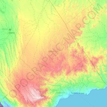
Name: Randa District topographic map, elevation, terrain.
Location: Randa District, Tadjourah, Djibouti (11.69934 42.45401 12.34583 42.94678)
Average elevation: 631 m
Minimum elevation: -153 m
Maximum elevation: 1,776 m
Other topographic maps
Click on a map to view its topography, its elevation and its terrain.