
Ngoro topographic map
Interactive map
Click on the map to display elevation.
About this map
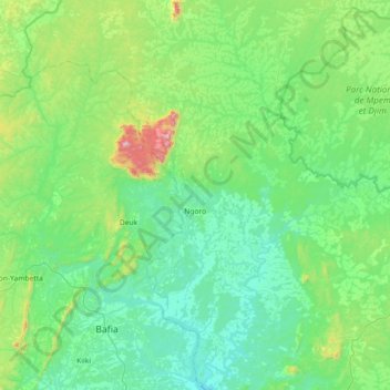
Name: Ngoro topographic map, elevation, terrain.
Location: Ngoro, Mbam-et-Kim, Centre, Cameroon (4.62759 11.23936 5.34877 11.81323)
Average elevation: 585 m
Minimum elevation: 395 m
Maximum elevation: 1,536 m
Other topographic maps
Click on a map to view its topography, its elevation and its terrain.