
Crodo topographic map
Click on the map to display elevation.
About this map
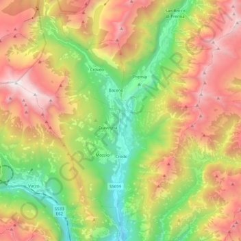
Name: Crodo topographic map, elevation, terrain.
Location: Crodo, Verbano-Cusio-Ossola, Piedmont, 28862, Italy (46.19429 8.19318 46.29262 8.38950)
Average elevation: 1,493 m
Minimum elevation: 339 m
Maximum elevation: 2,906 m
Other topographic maps
Click on a map to view its topography, its elevation and its terrain.
Mottarone
Italy > Piedmont > Verbano-Cusio-Ossola > Stresa
Mottarone is a mountain in the Western Alps of Piedmont, north-western Italy, with an elevation of 1,492 metres (4,895 ft). It is located between the provinces of Verbano-Cusio-Ossola and Novara.
Average elevation: 1,177 m
Giardini Botanici Villa Taranto
Italy > Piedmont > Verbano-Cusio-Ossola > Verbania
Average elevation: 210 m