Geolocate

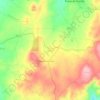
Freixo de Numão topographic map

Click on the map to display elevation.

About this map

Name: Freixo de Numão topographic map, elevation, terrain.

Location: Freixo de Numão, Vila Nova de Foz Côa, Guarda, 5155-235, Portugal (41.05100 -7.27915 41.09703 -7.18029)

Average elevation: 534 m

Minimum elevation: 206 m

Maximum elevation: 731 m

Other topographic maps

Click on a map to view its topography, its elevation and its terrain.

Cortes da Veiga

Portugal > Guarda > Vila Nova de Foz Coa

Average elevation: 217 m

Arnozelo

Portugal > Guarda > Vila Nova de Foz Coa > Numão

Average elevation: 283 m

Touça

Portugal > Guarda > Vila Nova de Foz Coa > Touça

Average elevation: 610 m

Cedovim

Portugal > Guarda > Vila Nova de Foz Coa

Average elevation: 613 m

Senhora do Viso

Portugal > Guarda > Vila Nova de Foz Coa

Average elevation: 601 m

Gear up for your next adventure:

📚UK Hiking Guidebooks - Detailed route descriptions for the Lake District, Peaks, and Highlands
🎒Replacement Sternum Straps - Repair parts for hiking rucksacks
🎒Hiking Backpacks - Comfortable backpacks for day hikes and multi-day treks
🔦Waterproof LED Headlamps - Hands-free lighting for evening treks and emergency navigation
🧤Hiking Gloves - Warm and durable gloves for cold-weather walks

As an Amazon Associate, this site earns from qualifying purchases at no extra cost to you.