Geolocate

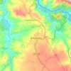
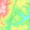
Cedovim topographic map

Click on the map to display elevation.

About this map

Name: Cedovim topographic map, elevation, terrain.

Location: Cedovim, Vila Nova de Foz Côa, Guarda, 6430-362, Portugal (40.98727 -7.35028 41.06727 -7.27028)

Average elevation: 613 m

Minimum elevation: 428 m

Maximum elevation: 941 m

Other topographic maps

Click on a map to view its topography, its elevation and its terrain.

Almendra

Portugal > Guarda > Vila Nova de Foz Coa

Average elevation: 366 m

Castelo Melhor

Portugal > Guarda > Vila Nova de Foz Coa

Average elevation: 334 m

Numão

Portugal > Guarda > Vila Nova de Foz Coa

Average elevation: 453 m

Touça

Portugal > Guarda > Vila Nova de Foz Coa

Average elevation: 610 m

Sebadelhe

Portugal > Guarda > Vila Nova de Foz Coa

Average elevation: 540 m

Numão

Portugal > Guarda > Vila Nova de Foz Coa

Average elevation: 453 m

Muxagata

Portugal > Guarda > Vila Nova de Foz Coa

Average elevation: 397 m

Gear up for your next adventure:

🍳Camping Stoves - Compact stoves for outdoor cooking
📷Outdoor Action Cameras - Cameras designed for hiking and adventure
👟Men's Trail Running Shoes - Lightweight grip for fast movement over topographic contours
🧥Packable Down Jackets - Lightweight warmth that compresses small in your bag
🕶️Glacier Goggles - Maximum protection for high-altitude snow topography

As an Amazon Associate, this site earns from qualifying purchases at no extra cost to you.