
Fräschels topographic map
Interactive map
Click on the map to display elevation.
About this map
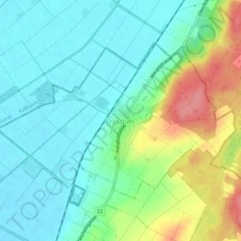
Name: Fräschels topographic map, elevation, terrain.
Location: Fräschels, Seebezirk, Freiburg, 3284, Schweiz (46.98933 7.18733 47.00680 7.22642)
Average elevation: 462 m
Minimum elevation: 433 m
Maximum elevation: 531 m
Fräschels liegt auf 457 m ü. M., 10 km nordöstlich des Bezirkshauptortes Murten (Luftlinie). Das Bauerndorf erstreckt sich am Ostrand des Grossen Mooses, am Fuss der angrenzenden Molassehöhen, im nördlichen Freiburger Mittelland. Fräschels ist die nördlichste Gemeinde des Kantons Freiburg.
Other topographic maps
Click on a map to view its topography, its elevation and its terrain.