
Bromley Green topographic map
Interactive map
Click on the map to display elevation.
About this map
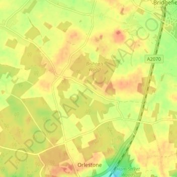
Name: Bromley Green topographic map, elevation, terrain.
Average elevation: 44 m
Minimum elevation: 19 m
Maximum elevation: 57 m
Kent trails, hiking, mountain biking, running and outdoor activities
Other topographic maps
Click on a map to view its topography, its elevation and its terrain.
Ham Street Woods National Nature Reserve
United Kingdom > England > Kent > Ashford > Hamstreet
Average elevation: 31 m
Wye National Nature Reserve
United Kingdom > England > Kent > Ashford > Brook
Average elevation: 123 m