
歌柳灣部落 topographic map
Interactive map
Click on the map to display elevation.
About this map
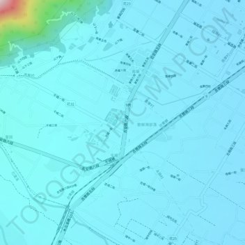
Name: 歌柳灣部落 topographic map, elevation, terrain.
Location: 歌柳灣部落, 干城村, 吉安鄉, 花蓮縣, 973, 臺灣, 圳 (23.94760 121.54749 23.94770 121.54777)
Average elevation: 80 m
Minimum elevation: 49 m
Maximum elevation: 431 m
Other topographic maps
Click on a map to view its topography, its elevation and its terrain.