
jivdhan fort topographic map
Interactive map
Click on the map to display elevation.
About this map
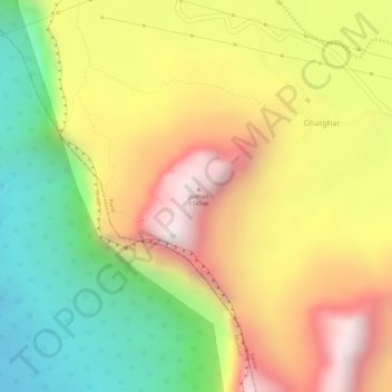
Name: jivdhan fort topographic map, elevation, terrain.
Location: jivdhan fort, Jivdhan route, Junnar, Pune, Maharashtra, India (19.27722 73.68706 19.27732 73.68716)
Average elevation: 709 m
Minimum elevation: 260 m
Maximum elevation: 1,131 m
Other topographic maps
Click on a map to view its topography, its elevation and its terrain.
Narayangaon
India > Maharashtra > Junnar > Narayangaon
Narayangaon, Junnar, Pune District, Maharashtra, 410504, India
Average elevation: 664 m