
St Margaret's Bay topographic map
Interactive map
Click on the map to display elevation.
About this map
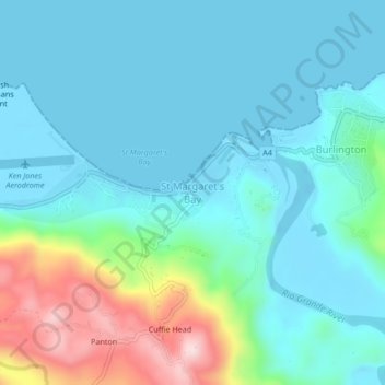
Name: St Margaret's Bay topographic map, elevation, terrain.
Location: St Margaret's Bay, Portland, Surrey County, Jamaica (18.17572 -76.53682 18.21572 -76.49682)
Average elevation: 70 m
Minimum elevation: -3 m
Maximum elevation: 345 m
Other topographic maps
Click on a map to view its topography, its elevation and its terrain.
Blue Mountain Peak
Blue Mountain Peak, Portland, Surrey County, Jamaica
Average elevation: 1,808 m
Orange Vale
Jamaica > Portland > Orange Vale
Orange Vale, Portland, Surrey County, Jamaica
Average elevation: 288 m
Ecclesdown (Bewitched)
Jamaica > Portland > Ecclesdown (Bewitched)
Ecclesdown (Bewitched), Portland, Surrey County, Jamaica
Average elevation: 378 m