Geolocate

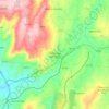
Terrenho topographic map

Click on the map to display elevation.

About this map

Name: Terrenho topographic map, elevation, terrain.

Location: Terrenho, Torre do Terrenho, Sebadelhe da Serra e Terrenho, Trancoso, Guarda, Portugal (40.85112 -7.38436 40.88237 -7.33594)

Average elevation: 809 m

Minimum elevation: 675 m

Maximum elevation: 961 m

Other topographic maps

Click on a map to view its topography, its elevation and its terrain.
Vila Franca das Naves

Portugal > Guarda > Trancoso

Average elevation: 598 m

Freches

Portugal > Guarda > Trancoso

Average elevation: 588 m

Corças

Portugal > Guarda > Trancoso

Average elevation: 825 m

Castaíde

Portugal > Guarda > Trancoso

Average elevation: 807 m

Ribeira do Freixo

Portugal > Guarda > Trancoso

Average elevation: 629 m

Esporões

Portugal > Guarda > Trancoso > Moreira de Rei

Average elevation: 723 m

Golfar

Portugal > Guarda > Trancoso > Moreira de Rei

Average elevation: 762 m

Gear up for your next adventure:

🐕Dog Hiking Gear - Equipment for hiking safely with dogs
🔋Solar Chargers - Eco-friendly charging solutions for outdoor use
🍳Camping Stoves - Compact stoves for outdoor cooking
🌦️Portable Weather Meters - Handheld tools for monitoring weather conditions
🗺️Scratch-off Peak Maps - Track your progress climbing Munros or Wainwrights

As an Amazon Associate, this site earns from qualifying purchases at no extra cost to you.