
Vallakkadavu topographic map
Interactive map
Click on the map to display elevation.
About this map
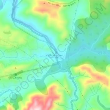
Name: Vallakkadavu topographic map, elevation, terrain.
Location: Vallakkadavu, Peerumade, Idukki, Kerala, India (9.50889 77.09042 9.54889 77.13042)
Average elevation: 922 m
Minimum elevation: 810 m
Maximum elevation: 1,188 m
Other topographic maps
Click on a map to view its topography, its elevation and its terrain.
Periyar National Park Tiger Reserve
Periyar National Park lies in the middle of a mountainous area of the Cardamom Hills. In the north, the boundary commences from the point nearest to the Medaganam in the interstate boundary up to Vellimalai. To the east the boundary follows the inter-state boundary from Vellimalai to Kallimalai Peak (1615 m)…
Average elevation: 929 m