
Yrgyz District topographic map
Interactive map
Click on the map to display elevation.
About this map
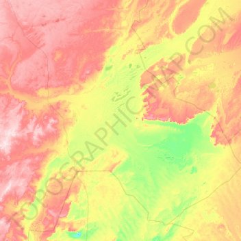
Name: Yrgyz District topographic map, elevation, terrain.
Location: Yrgyz District, Aktobe Region, 030400, Kazakhstan (47.17735 60.03630 49.63270 64.27717)
Average elevation: 129 m
Minimum elevation: 42 m
Maximum elevation: 322 m
Other topographic maps
Click on a map to view its topography, its elevation and its terrain.
Акмола
Акмола, Martuk District, Aktobe Region, Kazakhstan
Average elevation: 212 m
Mugalzhar District
Mugalzhar District, Aktobe Region, Kazakhstan
Average elevation: 279 m