
Make a donation
Gear up for your next adventure:
As an Amazon Associate, this site earns from qualifying purchases at no extra cost to you.
Aleutian Islands topographic map
Click on the map to display elevation.
Gear up for your next adventure:
As an Amazon Associate, this site earns from qualifying purchases at no extra cost to you.
About this map
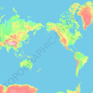
Name: Aleutian Islands topographic map, elevation, terrain.
Location: Aleutian Islands, Alaska, United States (51.21459 -179.14829 55.36467 179.77298)
Average elevation: 260 m
Minimum elevation: -2 m
Maximum elevation: 6,814 m
Make a donation
Gear up for your next adventure:
As an Amazon Associate, this site earns from qualifying purchases at no extra cost to you.
Other topographic maps
Click on a map to view its topography, its elevation and its terrain.
Denali
United States > Alaska > Denali Borough
Denali (/dəˈnɑːli/ də-NAH-lee), federally designated as Mount McKinley, is the highest mountain peak in North America, with a summit elevation of 20,310 feet (6,190 m) above sea level. It is the tallest mountain in the world from base to peak on land, measuring 18,000 ft (5,500 m). With a topographic…
Average elevation: 5,546 m
Make a donation
Gear up for your next adventure:
As an Amazon Associate, this site earns from qualifying purchases at no extra cost to you.
Make a donation
Gear up for your next adventure:
As an Amazon Associate, this site earns from qualifying purchases at no extra cost to you.
Make a donation
Gear up for your next adventure:
As an Amazon Associate, this site earns from qualifying purchases at no extra cost to you.
Denali
United States > Alaska > Denali Borough
Denali (/dəˈnɑːli/ də-NAH-lee), federally designated as Mount McKinley, is the highest mountain peak in North America, with a summit elevation of 20,310 feet (6,190 m) above sea level. It is the tallest mountain in the world from base to peak on land, measuring 18,000 ft (5,500 m). With a topographic…
Average elevation: 5,546 m
Flattop Mountain
United States > Alaska > Anchorage
It is usually reached by driving to the Glen Alps trailhead and following a 1.5-mile (2.4-km) trail, with an elevation gain of 1,280 feet (390 m) from the parking lot to the plateau. Off the plateau loop is a difficult trail to the peak. Since it is the most accessible mountain to Anchorage, Flattop is a very…
Average elevation: 735 m
Make a donation
Gear up for your next adventure:
As an Amazon Associate, this site earns from qualifying purchases at no extra cost to you.
Make a donation
Gear up for your next adventure:
As an Amazon Associate, this site earns from qualifying purchases at no extra cost to you.
Toolik Lake
United States > Alaska > North Slope Borough
Tussock tundra dominates the terrain surrounding the lake. Other plant communities in the area include wet sedge tundra, as well drier heath tundra found at higher elevations. Low growing shrubs are abundant, including birches and willows. Trees are not present. Since surveys began, there has been a 19 percent…
Average elevation: 731 m
Make a donation
Gear up for your next adventure:
As an Amazon Associate, this site earns from qualifying purchases at no extra cost to you.
Make a donation
Gear up for your next adventure:
As an Amazon Associate, this site earns from qualifying purchases at no extra cost to you.
Augustine Volcano
United States > Alaska > Kenai Peninsula Borough
The nearly circular uninhabited island formed by Augustine Volcano is 12 km (7.5 mi) wide east–west, 10 km (6.2 mi) north-south; a nearly symmetrical central summit peaks at altitude 4,134 feet (1,260 m).
Average elevation: 658 m
Mount Iliamna
United States > Alaska > Kenai Peninsula Borough
Holocene eruptive activity from Iliamna is little known, but radiocarbon dating seems to indicate at least a few eruptions, all before the European settlement of Alaska. Prehistoric eruptions have been dated to 5050 and 2050 BCE (VEI-4), 450 BCE and 1650. Historically observed eruptions took place in 1867…
Average elevation: 2,360 m
Make a donation
Gear up for your next adventure:
As an Amazon Associate, this site earns from qualifying purchases at no extra cost to you.
Augustine Volcano
United States > Alaska > Kenai Peninsula Borough
The nearly circular uninhabited island formed by Augustine Volcano is 12 km (7.5 mi) wide east–west, 10 km (6.2 mi) north-south; a nearly symmetrical central summit peaks at altitude 4,134 feet (1,260 m).
Average elevation: 658 m
Make a donation
Gear up for your next adventure:
As an Amazon Associate, this site earns from qualifying purchases at no extra cost to you.
Make a donation
Gear up for your next adventure:
As an Amazon Associate, this site earns from qualifying purchases at no extra cost to you.
Denali State Park
United States > Alaska > Matanuska-Susitna Borough
Denali State Park is in sight of Denali, the highest mountain peak in North America, with a summit elevation of 20,310 feet above sea level. Denali rises 18,000 feet from base to peak, making it the largest mountain situated entirely above sea level. To the east, the state park borders the Susitna River, which…
Average elevation: 702 m
Make a donation
Gear up for your next adventure:
As an Amazon Associate, this site earns from qualifying purchases at no extra cost to you.
Make a donation
Gear up for your next adventure:
As an Amazon Associate, this site earns from qualifying purchases at no extra cost to you.
Shishaldin Volcano
United States > Alaska > Aleutians East Borough
Shishaldin is located on Unimak Island, the easternmost of the Aleutian Islands. The nearest settlement to the volcano is False Pass (population ~100) at 45 km away. The view of Shishaldin from False Pass is obscured by the Round Top and Isanotski volcanoes, preventing direct observations of eruptions in many…
Average elevation: 2,134 m
Make a donation
Gear up for your next adventure:
As an Amazon Associate, this site earns from qualifying purchases at no extra cost to you.
Make a donation
Gear up for your next adventure:
As an Amazon Associate, this site earns from qualifying purchases at no extra cost to you.
Mount Fairweather
United States > Alaska > Yakutat
Mount Fairweather (or Tsalxaan in the Tlingit language) is a mountain located 20 km (12 mi) east of the Pacific Ocean on the Canada–United States border. With an elevation of 4,653 metres (15,266 ft), it is the tallest mountain in British Columbia and the seventh-tallest mountain in both Alaska and the…
Average elevation: 3,845 m
Make a donation
Gear up for your next adventure:
As an Amazon Associate, this site earns from qualifying purchases at no extra cost to you.
Make a donation
Gear up for your next adventure:
As an Amazon Associate, this site earns from qualifying purchases at no extra cost to you.
Make a donation
Gear up for your next adventure:
As an Amazon Associate, this site earns from qualifying purchases at no extra cost to you.
Denali
United States > Alaska > Denali Borough
Denali (/dəˈnɑːli/), federally designated as Mount McKinley, is the highest mountain peak in North America, with a summit elevation of 20,310 feet (6,190 m) above sea level. It is the tallest mountain in the world from base to peak on land, measuring 18,000 ft (5,500 m). With a topographic prominence of…
Average elevation: 5,546 m
Make a donation
Gear up for your next adventure:
As an Amazon Associate, this site earns from qualifying purchases at no extra cost to you.
Make a donation
Gear up for your next adventure:
As an Amazon Associate, this site earns from qualifying purchases at no extra cost to you.
Toolik Lake
United States > Alaska > North Slope Borough
Tussock tundra dominates the terrain surrounding the lake. Other plant communities in the area include wet sedge tundra, as well drier heath tundra found at higher elevations. Low growing shrubs are abundant, including birches and willows. Trees are not present. Since surveys began, there has been a 19 percent…
Average elevation: 731 m
Make a donation
Gear up for your next adventure:
As an Amazon Associate, this site earns from qualifying purchases at no extra cost to you.
Make a donation
Gear up for your next adventure:
As an Amazon Associate, this site earns from qualifying purchases at no extra cost to you.
Mount Katmai
United States > Alaska > Kodiak Island Borough
Mount Katmai (Russian: Катмай) is a large active stratovolcano (composite volcano) on the Alaska Peninsula in southern Alaska, located within Katmai National Park and Preserve. It is about 6.3 miles (10 km) in diameter with a central lake-filled caldera about two by three miles (3.2 by 4.8 km) in size,…
Average elevation: 1,515 m
Make a donation
Gear up for your next adventure:
As an Amazon Associate, this site earns from qualifying purchases at no extra cost to you.
Chatanika
United States > Alaska > Fairbanks North Star Borough
Located 2 miles (3.2 km) east of the confluence of Cleary Creek and the Chatanika River, Chatanika lies 20 miles (32 km) northeast of Fairbanks. Its altitude is 896 feet (273 m).
Average elevation: 272 m
Kasatochi Island
United States > Alaska > Unorganized Borough
Kasatochi Island is a member of the Aleutian Islands, which lie above a narrow ridge that separates the Bering Sea from the North Pacific. It lies at the Atka Pass northwest of the western tip of Atka Island and east of Great Sitkin Island. It is at 52.177° N latitude and 175.508° W longitude, with a summit…
Average elevation: 53 m
Mount Katmai
United States > Alaska > Kodiak Island Borough
Mount Katmai (Russian: Катмай) is a large active stratovolcano (composite volcano) on the Alaska Peninsula in southern Alaska, located within Katmai National Park and Preserve. It is about 6.3 miles (10 km) in diameter with a central lake-filled caldera about two by three miles (3.2 by 4.8 km) in size,…
Average elevation: 1,515 m
Make a donation
Gear up for your next adventure:
As an Amazon Associate, this site earns from qualifying purchases at no extra cost to you.